The Blue Loop

The Blue Loop interactive map

The Blue Loop is a continuous loop of waterways and riverside walkways in the heart of Sheffield, made up of the River Don and Tinsley Canal. It flows very close to Burngreave and is an amazing natural place right on the doorstep. It offers a place to walk, cycle and see wildlife which anyone of any age can enjoy absolutely free.

The Blue Loop Community Project has been funded by Natural England's Access to Nature and the Big Lottery Fund. As a result a number of resources have been made so that families, schools and community groups can use this green space.

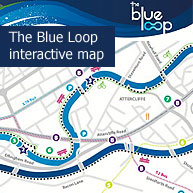
The resources include maps, activities for children, information about wildlife, walking routes and historical information. You can view, download and use all the resources at http://www.theblueloop.org/.

The Blue Loop interactive map

Logged in users of the website can add comments to this page.
Login to this site if you'd like to add a comment. Sign-up for an account if you are not currently a member.

<< | Up | >>

Print version

The content on this page was added to the website by Jamie Marriott on 2013-09-29 17:39:20.
The content of the page was last modified by Jamie Marriott on 2013-09-30 04:28:23.

Follow us on Twitter @TheBMessenger

All content is copyright © Burngreave Messenger Ltd. or its voluntary contributors, unless otherwise stated, not to be reproduced without permission. If you have any comments, or are interested in contributing to the Messenger and getting involved, please contact us.

Burngreave Messenger Ltd. Abbeyfield Park House, Abbeyfield Road, Sheffield S4 7AT.
Telephone: 0114 242 0564. Email: mail@burngreavemessenger.org
Company Limited by Guarantee: 04642734
Registered Charity: 1130836

The Burngreave Messenger is a community newspaper with editorial independence, funded by the Big Lottery, Foyle Foundation, Trusthouse Charitable Foundation, the Garfield Weston Foundation, the Scurrah Wainwright Charity, local residents and our advertisers.

Help the Messenger with a donation